Drone Survey Services in Denver, CO
From I-25 corridor infill projects to DIA expansion and Douglas County master-planned communities, Denver is a top-15 US construction market where mountain altitude and complex airspace shape every survey mission.
Serving Denver County & the Denver-Aurora-Lakewood area
Request a Free Quote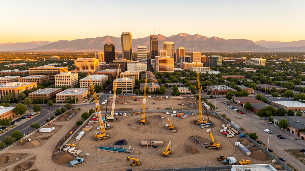
Get Matched With a Local Surveyor
Drone Survey Services Available in Denver, CO
The Denver-Aurora-Lakewood metro is a top-15 US construction market driven by transit-oriented development along the I-25 corridor, the Anschutz Medical Campus expansion in Aurora, and multi-phase growth at DIA. Douglas County ranks among the fastest-growing counties nationally, with master-planned communities in Highlands Ranch, Castle Rock, and Parker.
Drone Surveys for Denver's Construction Market
Denver consistently ranks among the top 15 US construction markets. The I-25 corridor from downtown to Lone Tree is seeing sustained mixed-use development, including transit-oriented projects near RTD light rail stations. Aurora continues to be a major growth driver, with the Anschutz Medical Campus expansion and large-scale residential builds in the northeast quadrant. Denver International Airport is undergoing a multi-phase terminal and concourse expansion. Douglas County remains one of the fastest-growing counties in the US, with master-planned communities in Highlands Ranch, Castle Rock, and Parker generating steady demand for topographic surveys and construction monitoring.
Active Developers in the Area:
Typical Project Costs in Colorado
Cost ranges are based on market data for Denver-Aurora-Lakewood. Actual pricing depends on site size, complexity, and deliverables.
| Service Type | Low End | High End |
|---|---|---|
| Topographic Survey | $2,000 | $5,000 |
| Drone Inspection | $250 | $900 |
| LiDAR Scanning | $3,000 | $9,000 |
| Environmental Monitoring | $900 | $3,500 |
| Aerial Imagery | $175 | $550 |
| Construction Monitoring | $1,200 | $3,500 |
| Real Estate Photography | $175 | $500 |
| Roof Inspection | $225 | $850 |
Local Airspace & Regulations in Denver, CO
FAA Part 107 Requirements
All commercial drone operations in Colorado require the pilot to hold an active FAA Part 107 Remote Pilot Certificate. Our network surveyors are verified Part 107 holders.
State Drone Laws
Colorado HB 1070 (2023) aligns state drone law with federal FAA Part 107 requirements. The law prohibits local municipalities from regulating drone flight paths or airspace, but allows cities to regulate takeoff and landing on public property. Colorado does not require a separate state-level drone license. Commercial drone operators must hold a valid FAA Part 107 Remote Pilot Certificate and comply with all federal regulations. The Colorado Department of Transportation has additional guidelines for drone operations near state highways and infrastructure.
Local Ordinances
Denver requires a commercial drone permit for operations taking off or landing on city-owned property, including parks and recreation areas. The Denver Office of Special Events issues permits for commercial drone flights during public events. Flights from private property (with owner permission) do not require a city permit but must comply with FAA Part 107 rules. Denver International Airport airspace coordination is managed through LAANC. The city prohibits drone flights over stadiums and large public gatherings (Broncos games at Empower Field, Nuggets/Avs at Ball Arena) without specific authorization.
Restricted Airspace
- Class B airspace around Denver International (DEN) — extends 10 nautical miles from the airport, surface to 12,000 ft MSL. LAANC authorization required for all commercial drone flights within this zone.
- Buckley Space Force Base (Aurora) — restricted military airspace, active flight operations. Drone flights within 5 miles require prior coordination with base operations.
- Rocky Mountain Arsenal National Wildlife Refuge (Commerce City) — permanent TFR prohibiting drone flights below 3,000 ft AGL. Managed by US Fish and Wildlife Service.
- Class D airspace around Centennial Airport (APA) — requires LAANC authorization for commercial operations within 4 nautical miles.
- Denver Parks and Recreation prohibits drone takeoff/landing on city park property without a special use permit. Washington Park, Cheesman Park, and City Park are actively patrolled.
- High-altitude operations: Denver sits at 5,280 ft elevation. Drone performance is reduced due to thinner air. Pilots must account for density altitude when calculating flight times and payload capacity.
Airports in the area: undefined (undefined), undefined (undefined), undefined (undefined), undefined (undefined)
Why Hire Through Aerius View in Denver, CO?
FAA-Certified
Every surveyor holds an active Part 107 Remote Pilot Certificate.
Local to Denver
Surveyors who know the Colorado airspace and local permitting.
No Cost to Quote
Submit your project at no charge. Pay the surveyor directly if you proceed.
Fast Turnaround
A local surveyor contacts you within 2 business days.
How Our Denver Matching Process Works
We're actively building our network of FAA-certified drone operators in Denver, CO. Here's exactly what happens when you submit a project request.
Submit Your Project
Tell us your site location, acreage, and what you need (topographic survey, LiDAR, inspection, etc.). Takes 60 seconds. No cost, no obligation.
We Match & Vet
We identify Part 107-certified operators in Colorado with the right equipment for your project. Every pilot is verified for active certification, insurance, and relevant experience in Colorado airspace.
You Get Quotes
Matched surveyors contact you within 2 business days with quotes. You compare pricing, timelines, and deliverables, then choose the right fit. You pay the surveyor directly, no markup.
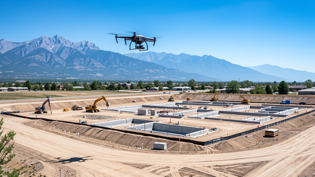
What Deliverables Do You Get?
Every project includes professional-grade deliverables compatible with standard construction and engineering software:
- Orthomosaic maps (GeoTIFF) for site overview and documentation
- Point clouds (LAS/LAZ) for 3D modeling and volumetric analysis
- DEM/DSM terrain models for cut/fill and grade analysis
- Contour lines (DXF/DWG, CAD-ready) for Civil 3D and Revit
- Progress reports with side-by-side comparisons for construction monitoring
- Coordinate systems matched to your project datum (State Plane, UTM, or local)
Insurance & Liability Protection
Pilot Insurance Required
Every operator in our network must carry active liability insurance. Minimum coverage: $1,000,000 general liability. Proof of insurance is verified before any pilot joins the network.
FAA Part 107 Verified
We confirm each pilot's Remote Pilot Certificate is active and in good standing through the FAA Airmen Inquiry system. Expired certificates are flagged automatically.
Equipment Documentation
Pilots list their drone models, sensors (RGB, LiDAR, thermal, multispectral), and payload specs so we can match the right equipment to your project requirements.
Site Safety Coordination
Pilots coordinate with your site superintendent for safe operations on active construction sites, including flight plans that avoid worker areas and equipment zones.
Denver, CO Drone Survey FAQs
Do I need a permit for a drone survey in Denver?
You need a commercial drone permit only if you plan to take off or land on city-owned property, including parks. Surveys conducted from private property (with owner permission) do not require a Denver city permit. All commercial drone operations require an FAA Part 107 Remote Pilot Certificate.
How much does a drone survey cost in Colorado?
Costs vary by service type. Topographic surveys in the Denver metro typically range from $2,000 to $5,000. Roof inspections run $225-$850. LiDAR scanning for larger or mountainous sites can cost $3,000-$9,000. Real estate drone photography starts at $175.
Can drones fly near Denver International Airport?
Denver International (DEN) has Class B controlled airspace extending up to 10 nautical miles from the airport. Commercial drone flights within this airspace require LAANC (Low Altitude Authorization and Notification Capability) authorization from the FAA. Our network surveyors handle all LAANC approvals.
Does Denver's high altitude affect drone operations?
Yes. Denver sits at 5,280 feet elevation, which means thinner air and reduced drone performance. Flight times are typically 15-20% shorter than at sea level, and payload capacity is reduced. Our local surveyors account for density altitude when planning missions and selecting equipment.
Are there restricted military airspace zones near Denver?
Yes. Buckley Space Force Base in Aurora has restricted military airspace and active flight operations. Drone flights within 5 miles of the base require prior coordination. The Rocky Mountain Arsenal National Wildlife Refuge in Commerce City has a permanent TFR prohibiting drone flights below 3,000 feet.
How long does a topographic survey take in Denver?
A standard 50-acre site can be flown in a single morning, weather permitting. Deliverables (DEM, contour maps, orthomosaic, point cloud) are typically ready within 3-5 business days. Mountainous sites or projects requiring ground control point placement may take longer. Afternoon thunderstorms are common in summer, so morning flights are preferred.
Nearby Cities
Are You a Drone Surveyor in Denver?
Get pre-qualified leads in your service area. No membership fees, no monthly minimums. First lead free.
Ready to Start Your Project in Denver, CO?
Get matched with a local, FAA-certified surveyor. No cost, no obligation.
Request a Free Quote