Drone Survey Services in Arvada, CO
Arvada G Line transit corridor and the massive Candelas and Leyden Rock master-planned communities in the northwest corridor are transforming the city western edge into one of Jefferson County most active residential and TOD construction zones.
Serving Jefferson County & the Denver-Aurora-Lakewood MSA area
Request a Free Quote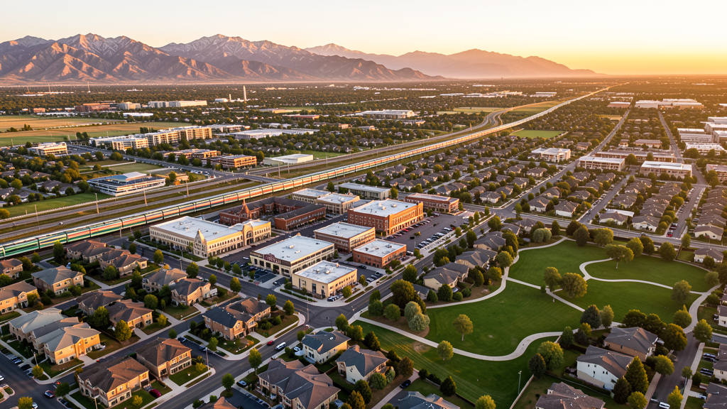
Get Matched With a Local Surveyor
Drone Survey Services Available in Arvada, CO
Arvada is the eighth-largest city in Colorado and a key node in the Denver metro northwest corridor, with growth driven by G Line commuter rail transit-oriented development and large master-planned communities like Candelas and Leyden Rock. The city proximity to Rocky Mountain Metropolitan Airport (BJC) creates significant Class D airspace constraints for drone operators across much of the city. The adjacent Rocky Flats National Wildlife Refuge adds a federally-restricted no-drone zone along the northwestern boundary.
Drone Surveys for Arvada's Construction Market
Arvada construction market is driven by transit-oriented development along the G Line commuter rail corridor, particularly at the Olde Town Arvada station and future station areas. The city NW corridor growth includes major residential development in the Candelas (1,500+ acre master-planned community) and Leyden Rock master-planned communities west of Indiana Street. Commercial expansion along the Wadsworth BRT corridor and historic Olde Town Arvada mixed-use infill add to construction activity. The city is actively planning for growth along the Indiana Street corridor.
Active Developers in the Area:

Typical Project Costs in Colorado
Cost ranges are based on market data for Denver-Aurora-Lakewood MSA. Actual pricing depends on site size, complexity, and deliverables.
| Service Type | Low End | High End |
|---|---|---|
| Topographic Survey | $1,200 | $4,500 |
| Drone Inspection | $800 | $3,000 |
| LiDAR Scanning | $2,500 | $8,000 |
| Environmental Monitoring | $1,500 | $5,000 |
| Aerial Imagery | $600 | $2,000 |
| Construction Monitoring | $1,000 | $3,500 |
| Real Estate Photography | $300 | $1,100 |
| Roof Inspection | $250 | $950 |
Local Airspace & Regulations in Arvada, CO
FAA Part 107 Requirements
All commercial drone operations in Colorado require the pilot to hold an active FAA Part 107 Remote Pilot Certificate. Our network surveyors are verified Part 107 holders.
State Drone Laws
Colorado HB 1070 (2023) aligns state drone law with federal FAA Part 107 requirements. The law prohibits local municipalities from regulating drone flight paths or airspace, but allows cities to regulate takeoff and landing on public property. Colorado does not require a separate state-level drone license. Commercial drone operators must hold a valid FAA Part 107 Remote Pilot Certificate and comply with all federal regulations. The Colorado Department of Transportation has additional guidelines for drone operations near state highways and infrastructure.
Local Ordinances
Arvada Municipal Code prohibits drone takeoff and landing in all city parks, open spaces, and trail systems without a special use permit from Arvada Parks, Golf, and Hospitality. This includes Majestic View Nature Center, Two Ponds National Wildlife Refuge buffer zone, Arvada Reservoir area, and the Ralston Creek trail corridor. Jefferson County Open Space rules prohibit drone takeoff and landing on all JCOS properties adjacent to Arvada. All drone operations over Rocky Flats National Wildlife Refuge are prohibited by USFWS regulation (50 CFR 27.34).
Restricted Airspace
- BJC Class D surface area — immediately adjacent to Arvada (only 4 miles north). Most of northern and central Arvada falls within or near the BJC Class D. LAANC available. This is the most significant airspace constraint for Arvada drone operations.
- DEN Class B shelf extends over southeastern Arvada at 8,000-10,000 MSL. LAANC available via DEN approach.
- Rocky Flats National Wildlife Refuge — located immediately northwest of Arvada. USFWS prohibits all drone operations over refuge lands (50 CFR 27.34). Former nuclear weapons production site, now wildlife refuge. No exceptions for Part 107 pilots.
- Buckley SFB — located 20 miles southeast. TFRs frequently active. Check active TFRs before flying.
- Stadium TFRs — Coors Field (8 miles southeast) and Empower Field at Mile High (10 miles southeast) trigger game-day TFRs that may extend over eastern Arvada.
Airports in the area: undefined (undefined), undefined (undefined), undefined (undefined)
Why Hire Through Aerius View in Arvada, CO?
FAA-Certified
Every surveyor holds an active Part 107 Remote Pilot Certificate.
Local to Arvada
Surveyors who know the Colorado airspace and local permitting.
No Cost to Quote
Submit your project at no charge. Pay the surveyor directly if you proceed.
Fast Turnaround
A local surveyor contacts you within 2 business days.
How Our Arvada Matching Process Works
We're actively building our network of FAA-certified drone operators in Arvada, CO. Here's exactly what happens when you submit a project request.
Submit Your Project
Tell us your site location, acreage, and what you need (topographic survey, LiDAR, inspection, etc.). Takes 60 seconds. No cost, no obligation.
We Match & Vet
We identify Part 107-certified operators in Colorado with the right equipment for your project. Every pilot is verified for active certification, insurance, and relevant experience in Colorado airspace.
You Get Quotes
Matched surveyors contact you within 2 business days with quotes. You compare pricing, timelines, and deliverables, then choose the right fit. You pay the surveyor directly, no markup.
What Deliverables Do You Get?
Every project includes professional-grade deliverables compatible with standard construction and engineering software:
- Orthomosaic maps (GeoTIFF) for site overview and documentation
- Point clouds (LAS/LAZ) for 3D modeling and volumetric analysis
- DEM/DSM terrain models for cut/fill and grade analysis
- Contour lines (DXF/DWG, CAD-ready) for Civil 3D and Revit
- Progress reports with side-by-side comparisons for construction monitoring
- Coordinate systems matched to your project datum (State Plane, UTM, or local)
Insurance & Liability Protection
Pilot Insurance Required
Every operator in our network must carry active liability insurance. Minimum coverage: $1,000,000 general liability. Proof of insurance is verified before any pilot joins the network.
FAA Part 107 Verified
We confirm each pilot's Remote Pilot Certificate is active and in good standing through the FAA Airmen Inquiry system. Expired certificates are flagged automatically.
Equipment Documentation
Pilots list their drone models, sensors (RGB, LiDAR, thermal, multispectral), and payload specs so we can match the right equipment to your project requirements.
Site Safety Coordination
Pilots coordinate with your site superintendent for safe operations on active construction sites, including flight plans that avoid worker areas and equipment zones.
Arvada, CO Drone Survey FAQs
Can I fly a drone near the Rocky Mountain Metropolitan Airport (BJC) in Arvada?
BJC is only 4 miles north of Arvada, and the BJC Class D surface area extends over much of northern and central Arvada. You must obtain LAANC authorization before flying in this area. LAANC is available through FAA-approved providers (Aloft, AirMap, DroneUp). The Class D surface area typically extends to a 4.3-nautical-mile radius around BJC. Check your exact coordinates against the FAA UAS Facility Map for BJC.
Are drones allowed over the Rocky Flats National Wildlife Refuge near Arvada?
No. All drone operations over the Rocky Flats National Wildlife Refuge are prohibited by USFWS regulation (50 CFR 27.34). The refuge is located immediately northwest of Arvada and borders the Candelas community. This is a federal prohibition with no exceptions for Part 107 pilots. The refuge was formerly a nuclear weapons production facility, and while it has been remediated and designated as wildlife habitat, drone overflights remain prohibited.
What is the G Line corridor and why does it matter for drone surveys?
The G Line is RTD commuter rail line connecting Union Station in Denver to Wheat Ridge and Arvada, with stations at Olde Town Arvada, Arvada Ridge, and Ward Road. Transit-oriented development around these stations is driving significant mixed-use and multifamily construction, creating demand for aerial survey, progress monitoring, and as-built documentation throughout the corridor.
Can I launch a drone from Arvada city parks for a survey project?
No, not without a special use permit. Arvada Municipal Code prohibits drone takeoff and landing in all city parks, open spaces, and trail systems without a special use permit from Arvada Parks, Golf, and Hospitality. This includes Majestic View Nature Center, the Ralston Creek trail corridor, and the Arvada Reservoir area. You must launch from private property with owner permission or from non-restricted public land.
What major residential developments are driving construction in Arvada?
Candelas (1,500+ acre master-planned community in northwest Arvada) and Leyden Rock (foothills community developed by Oakwood Homes) are the two largest residential projects. Both are in the northwest corridor near Indiana Street and require extensive topographic, environmental, and construction-phase survey work. Combined, these communities represent thousands of new housing units in active construction phases.
Nearby Cities
Are You a Drone Surveyor in Arvada?
Get pre-qualified leads in your service area. No membership fees, no monthly minimums. First lead free.
Ready to Start Your Project in Arvada, CO?
Get matched with a local, FAA-certified surveyor. No cost, no obligation.
Request a Free Quote