Drone Survey Services in Yuma, AZ
From MCAS Yuma military infrastructure and solar farm development to agricultural processing facilities and Foothills residential growth, Yuma is a unique construction market where massive military restricted airspace and agricultural productivity shape every survey mission.
Serving Yuma County & the Yuma area
Request a Free Quote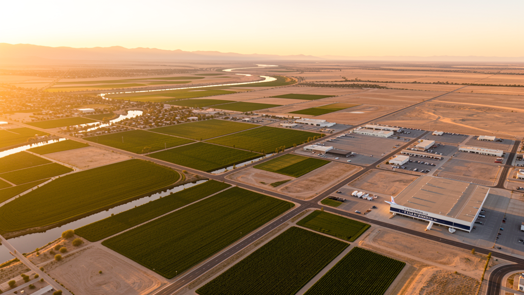
Get Matched With a Local Surveyor
Drone Survey Services Available in Yuma, AZ
Yuma is driven by military infrastructure at MCAS Yuma, agricultural processing, and solar energy development. The Barry M. Goldwater Range creates massive restricted airspace to the south. The Foothills residential area generates growth. Yuma County agriculture is among the most productive in the nation.
Drone Surveys for Yuma's Construction Market
Yuma is a unique construction market driven by military infrastructure at MCAS Yuma, agricultural processing facilities, and solar energy development. The Marine Corps has invested heavily in base infrastructure including new hangars and training facilities. The Yuma Proving Ground nearby generates additional military construction demand. Solar farm development in the Yuma area, one of the sunniest locations in the US, is a major growth sector with projects including the Agua Caliente Solar project. Agricultural processing facilities and cold storage warehouses require ongoing construction and expansion. Residential growth in the Foothills area east of Yuma generates demand for topographic surveys and construction monitoring.
Active Developers in the Area:
Typical Project Costs in Arizona
Cost ranges are based on market data for Yuma. Actual pricing depends on site size, complexity, and deliverables.
| Service Type | Low End | High End |
|---|---|---|
| Topographic Survey | $1,800 | $4,500 |
| Drone Inspection | $250 | $850 |
| LiDAR Scanning | $2,800 | $8,500 |
| Environmental Monitoring | $800 | $3,200 |
| Aerial Imagery | $175 | $500 |
| Construction Monitoring | $1,200 | $3,200 |
| Real Estate Photography | $175 | $450 |
| Roof Inspection | $225 | $800 |
Local Airspace & Regulations in Yuma, AZ
FAA Part 107 Requirements
All commercial drone operations in Arizona require the pilot to hold an active FAA Part 107 Remote Pilot Certificate. Our network surveyors are verified Part 107 holders.
State Drone Laws
Arizona SB 1449 (2016) was the first state law regulating drone use, prohibiting drone operations that interfere with law enforcement, emergency responders, or wildfire suppression efforts. The law prohibits drone flights within 3 miles of a wildfire or prescribed burn and makes violation a class 1 misdemeanor. ARS Title 13 Chapter 29 Article 3 restricts drone surveillance of private property and weaponization of drones. Commercial operators must hold a valid FAA Part 107 Remote Pilot Certificate. Arizona does not require a separate state drone license, but operators must comply with FAA Part 107 rules and any local ordinances. The Arizona Department of Public Safety maintains guidelines for drone operations near critical infrastructure including power plants, dams, and military installations.
Local Ordinances
Yuma requires a commercial drone permit for operations taking off or landing on city-owned property, including parks and recreation areas. The Yuma Parks and Recreation Department issues permits. Flights from private property with owner permission do not require a city permit but must comply with FAA Part 107 rules. Yuma International Airport and MCAS Yuma airspace coordination is managed through LAANC for the civilian side. The city prohibits drone flights over large public gatherings at Arizona Western College events and the Yuma County Fairgrounds without specific authorization. The heavy military presence means operators must be especially vigilant about restricted airspace boundaries.
Restricted Airspace
- Class D airspace around Yuma International Airport (YUM) — extends 5 nautical miles. LAANC authorization required for commercial drone flights within this zone. The airport shares facilities with Marine Corps Air Station Yuma.
- Marine Corps Air Station Yuma (MCAS) — one of the busiest military aviation facilities in the country. Restricted military airspace extends well beyond the base. Drone flights within 5 miles require prior coordination with base operations. AV-8B Harrier and F-35B training squadrons operate here.
- Barry M. Goldwater Air Force Range (BMGR) — massive military training range southwest of Yuma covering 1.7 million acres. Permanent restricted airspace (R-2301, R-2304, R-2305, R-2310). Drone flights are strictly prohibited throughout the range.
- Imperial National Wildlife Refuge along the Colorado River — US Fish and Wildlife Service prohibits drone flights below 3,000 ft AGL.
- Agricultural areas: Yuma County is one of the most productive agricultural regions in the US. Drone flights over agricultural fields should coordinate with landowners and farm operators, especially during harvest season.
Airports in the area: undefined (undefined), undefined (undefined), undefined (undefined)
Why Hire Through Aerius View in Yuma, AZ?
FAA-Certified
Every surveyor holds an active Part 107 Remote Pilot Certificate.
Local to Yuma
Surveyors who know the Arizona airspace and local permitting.
No Cost to Quote
Submit your project at no charge. Pay the surveyor directly if you proceed.
Fast Turnaround
A local surveyor contacts you within 2 business days.
How Our Yuma Matching Process Works
We're actively building our network of FAA-certified drone operators in Yuma, AZ. Here's exactly what happens when you submit a project request.
Submit Your Project
Tell us your site location, acreage, and what you need (topographic survey, LiDAR, inspection, etc.). Takes 60 seconds. No cost, no obligation.
We Match & Vet
We identify Part 107-certified operators in Arizona with the right equipment for your project. Every pilot is verified for active certification, insurance, and relevant experience in Arizona airspace.
You Get Quotes
Matched surveyors contact you within 2 business days with quotes. You compare pricing, timelines, and deliverables, then choose the right fit. You pay the surveyor directly, no markup.
What Deliverables Do You Get?
Every project includes professional-grade deliverables compatible with standard construction and engineering software:
- Orthomosaic maps (GeoTIFF) for site overview and documentation
- Point clouds (LAS/LAZ) for 3D modeling and volumetric analysis
- DEM/DSM terrain models for cut/fill and grade analysis
- Contour lines (DXF/DWG, CAD-ready) for Civil 3D and Revit
- Progress reports with side-by-side comparisons for construction monitoring
- Coordinate systems matched to your project datum (State Plane, UTM, or local)
Insurance & Liability Protection
Pilot Insurance Required
Every operator in our network must carry active liability insurance. Minimum coverage: $1,000,000 general liability. Proof of insurance is verified before any pilot joins the network.
FAA Part 107 Verified
We confirm each pilot's Remote Pilot Certificate is active and in good standing through the FAA Airmen Inquiry system. Expired certificates are flagged automatically.
Equipment Documentation
Pilots list their drone models, sensors (RGB, LiDAR, thermal, multispectral), and payload specs so we can match the right equipment to your project requirements.
Site Safety Coordination
Pilots coordinate with your site superintendent for safe operations on active construction sites, including flight plans that avoid worker areas and equipment zones.
Yuma, AZ Drone Survey FAQs
Do I need a permit for a drone survey in Yuma?
You need a commercial drone permit only if you plan to take off or land on city-owned property, including parks. Surveys from private property with owner permission do not require a Yuma city permit. All commercial operations require FAA Part 107 certification. The heavy military presence means extra attention to restricted airspace is essential.
Can I fly drones near Marine Corps Air Station Yuma?
MCAS Yuma is one of the busiest military aviation facilities in the country. Restricted military airspace extends well beyond the base. Drone flights within 5 miles require prior coordination with base operations. The base shares facilities with Yuma International Airport, creating a complex airspace environment.
What is the Barry M. Goldwater Air Force Range?
The Barry M. Goldwater Range (BMGR) is a 1.7-million-acre military training range southwest of Yuma with permanent restricted airspace. Drone flights are strictly prohibited throughout the range. The restricted airspace zones include R-2301, R-2304, R-2305, and R-2310. Always check sectional charts before flying south or west of Yuma.
Can I survey agricultural fields with drones in Yuma?
Yuma County is one of the most productive agricultural regions in the US. Drone flights over agricultural fields should coordinate with landowners and farm operators, especially during harvest season. Agricultural drone survey for crop health, irrigation monitoring, and precision agriculture is a growing market. Ensure you have landowner permission and comply with FAA Part 107 rules.
How much does a drone survey cost in Yuma?
Topographic surveys range from $1,800 to $4,500. Roof inspections run $225-$800. LiDAR scanning for larger or remote sites can cost $2,800-$8,500. Agricultural drone survey services are a growing market. Solar farm survey and inspection work may have specialized pricing.
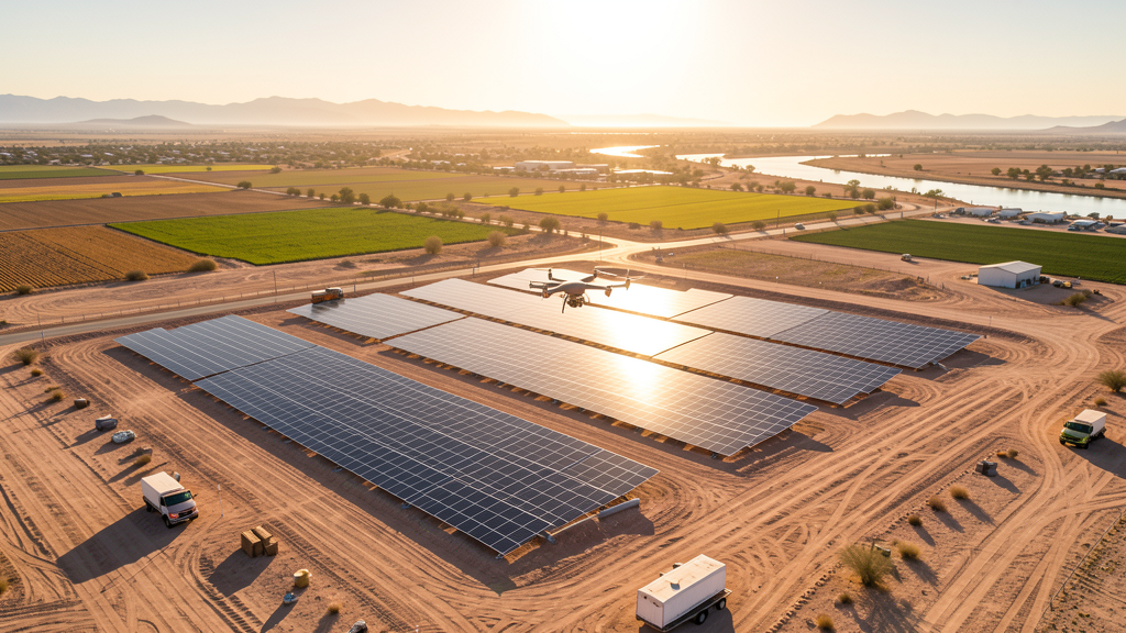
What about solar farm drone inspections in Yuma?
Yuma is one of the sunniest locations in the US, making it ideal for solar energy. Solar farm development is a major growth sector. Drone inspections of solar panel arrays for thermal defects (hot spots) using infrared cameras are a specialized service. Coordinate with facility operators before conducting inspection work over solar installations.
Nearby Cities
Are You a Drone Surveyor in Yuma?
Get pre-qualified leads in your service area. No membership fees, no monthly minimums. First lead free.
Ready to Start Your Project in Yuma, AZ?
Get matched with a local, FAA-certified surveyor. No cost, no obligation.
Request a Free Quote