Drone Survey Services in Brighton, CO
Brighton is experiencing rapid growth driven by the 1,700-acre Prairie Center mega-development and multiple master-planned residential communities, making it one of the most active construction survey markets in the northern Denver metro corridor.
Serving Adams County & the Denver-Aurora-Lakewood MSA area
Request a Free Quote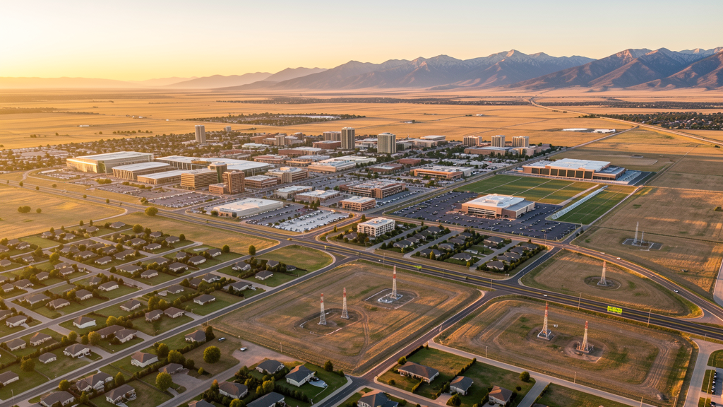
Get Matched With a Local Surveyor
Drone Survey Services Available in Brighton, CO
Brighton sits at the northeast edge of the Denver metropolitan area in Adams County, positioned along the I-76 and E-470 corridors. The city has transformed from an agricultural community into one of the fastest-growing suburbs in the region, with residential, commercial, and industrial development all expanding simultaneously.
Drone Surveys for Brighton's Construction Market
Brighton is one of the fastest-growing cities in the Denver metropolitan area, with population growth exceeding 2.5% annually. The Prairie Center development by L.C. Fulenwider Inc. spans over 1,700 acres along I-76 and represents one of the largest master-planned commercial and industrial projects in Adams County. Residential construction is booming with multiple master-planned communities including Brighton Crossing, Bromley Park, and River Run, while Adams County continues to invest in infrastructure improvements along the I-76 corridor and E-470 interchange areas.
Active Developers in the Area:

Typical Project Costs in Colorado
Cost ranges are based on market data for Denver-Aurora-Lakewood MSA. Actual pricing depends on site size, complexity, and deliverables.
| Service Type | Low End | High End |
|---|---|---|
| Topographic Survey | $900 | $3,200 |
| Drone Inspection | $650 | $2,600 |
| LiDAR Scanning | $1,600 | $5,200 |
| Environmental Monitoring | $950 | $3,600 |
| Aerial Imagery | $450 | $1,600 |
| Construction Monitoring | $750 | $2,900 |
| Real Estate Photography | $350 | $1,300 |
| Roof Inspection | $400 | $1,100 |
Local Airspace & Regulations in Brighton, CO
FAA Part 107 Requirements
All commercial drone operations in Colorado require the pilot to hold an active FAA Part 107 Remote Pilot Certificate. Our network surveyors are verified Part 107 holders.
State Drone Laws
Colorado HB 1070 (2023) aligns state drone law with federal FAA Part 107 requirements. The law prohibits local municipalities from regulating drone flight paths or airspace, but allows cities to regulate takeoff and landing on public property. Colorado does not require a separate state-level drone license. Commercial drone operators must hold a valid FAA Part 107 Remote Pilot Certificate and comply with all federal regulations. The Colorado Department of Transportation has additional guidelines for drone operations near state highways and infrastructure.
Local Ordinances
Brighton Municipal Code Chapter 10.60 requires commercial drone operators to comply with FAA Part 107 regulations and register with the city if conducting commercial operations within city limits. Brighton Municipal Code Chapter 12.08 prohibits takeoff and landing of unmanned aircraft in city parks without prior authorization from the Parks and Recreation Director. Film permits for commercial photography including drone cinematography are issued through the City Clerks Office with at least 5 business days advance notice.
Restricted Airspace
- KDEN Class B outer shelves extend over southern Brighton at 8,000-10,000 MSL. Standard drone operations below 400 AGL are below the shelf floor.
- KFTG Class D surface to 8,000 MSL within 5 NM. Southeastern corner of Brighton may fall within this area. LAANC authorization required.
- Buckley Space Force Base (18 miles southeast) has associated airspace restrictions and TFRs that can affect the broader area.
- Barr Lake State Park immediately south of Brighton. Colorado state parks prohibit drone takeoff and landing without a special use permit from CPW.
- Oil and gas infrastructure in eastern Adams County with well pads and pipelines. Operators should maintain safe distances from active facilities.
Airports in the area: undefined (undefined), undefined (undefined), undefined (undefined)
Why Hire Through Aerius View in Brighton, CO?
FAA-Certified
Every surveyor holds an active Part 107 Remote Pilot Certificate.
Local to Brighton
Surveyors who know the Colorado airspace and local permitting.
No Cost to Quote
Submit your project at no charge. Pay the surveyor directly if you proceed.
Fast Turnaround
A local surveyor contacts you within 2 business days.
How Our Brighton Matching Process Works
We're actively building our network of FAA-certified drone operators in Brighton, CO. Here's exactly what happens when you submit a project request.
Submit Your Project
Tell us your site location, acreage, and what you need (topographic survey, LiDAR, inspection, etc.). Takes 60 seconds. No cost, no obligation.
We Match & Vet
We identify Part 107-certified operators in Colorado with the right equipment for your project. Every pilot is verified for active certification, insurance, and relevant experience in Colorado airspace.
You Get Quotes
Matched surveyors contact you within 2 business days with quotes. You compare pricing, timelines, and deliverables, then choose the right fit. You pay the surveyor directly, no markup.
What Deliverables Do You Get?
Every project includes professional-grade deliverables compatible with standard construction and engineering software:
- Orthomosaic maps (GeoTIFF) for site overview and documentation
- Point clouds (LAS/LAZ) for 3D modeling and volumetric analysis
- DEM/DSM terrain models for cut/fill and grade analysis
- Contour lines (DXF/DWG, CAD-ready) for Civil 3D and Revit
- Progress reports with side-by-side comparisons for construction monitoring
- Coordinate systems matched to your project datum (State Plane, UTM, or local)
Insurance & Liability Protection
Pilot Insurance Required
Every operator in our network must carry active liability insurance. Minimum coverage: $1,000,000 general liability. Proof of insurance is verified before any pilot joins the network.
FAA Part 107 Verified
We confirm each pilot's Remote Pilot Certificate is active and in good standing through the FAA Airmen Inquiry system. Expired certificates are flagged automatically.
Equipment Documentation
Pilots list their drone models, sensors (RGB, LiDAR, thermal, multispectral), and payload specs so we can match the right equipment to your project requirements.
Site Safety Coordination
Pilots coordinate with your site superintendent for safe operations on active construction sites, including flight plans that avoid worker areas and equipment zones.
Brighton, CO Drone Survey FAQs
What airspace restrictions affect drone flights in Brighton, Colorado?
Brighton sits north of the Denver Class B airspace surface area but is affected by higher-altitude Class B shelves on the southern edge. The Colorado Air and Space Port (FTG) Class D airspace, approximately 12 miles southeast, has a surface-to-8,000-MSL ring that may reach the southeast corner. Most of central and northern Brighton at altitudes below 400 AGL is Class E or uncontrolled, making it relatively accessible for Part 107 operations.
Can I fly a drone in Barr Lake State Park near Brighton?
No, drone takeoff and landing are prohibited in Colorado state parks, including Barr Lake State Park, without a special use permit from Colorado Parks and Wildlife. Barr Lake State Park is immediately south of Brighton and is a popular wildlife viewing area, making it particularly sensitive to drone disturbance. Operators needing to survey near the park boundary should fly from outside park property.
Do I need a permit to fly a commercial drone in the city of Brighton?
Yes. Brighton Municipal Code Chapter 10.60 requires commercial drone operators to comply with FAA Part 107 regulations. If operating in city parks, you need authorization from the Brighton Parks and Recreation Director under Chapter 12.08. For aerial cinematography or film production, a separate film permit from the City Clerks Office is required.
What major construction projects are driving demand for drone surveys in Brighton?
The Prairie Center development, a 1,700+ acre master-planned community by L.C. Fulenwider Inc. along I-76, is the largest single driver. Multiple residential subdivisions including Brighton Crossing (Shea Homes), Bromley Park, and River Run are under active construction. Adams County infrastructure spending along the I-76 corridor and E-470 interchange improvements creates ongoing demand.
How does the oil and gas infrastructure in Adams County affect drone survey operations near Brighton?
Eastern Brighton and surrounding Adams County have significant oil and gas well pads, pipelines, and processing facilities. Drone flights near critical infrastructure may be restricted. Operators should review current FAA facility maps and NOTAMs. Colorado SB 19-181 increased setback requirements, creating demand for drone-based environmental and compliance surveys around well sites.
Nearby Cities
Are You a Drone Surveyor in Brighton?
Get pre-qualified leads in your service area. No membership fees, no monthly minimums. First lead free.
Ready to Start Your Project in Brighton, CO?
Get matched with a local, FAA-certified surveyor. No cost, no obligation.
Request a Free Quote