Drone Survey Services in Commerce City, CO
Commerce City is experiencing rapid industrial and residential growth along the I-76 and Tower Road corridors, with major master-planned communities and logistics warehouse projects creating sustained demand for drone survey services.
Serving Adams County & the Denver-Aurora-Lakewood MSA area
Request a Free Quote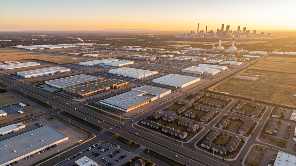
Get Matched With a Local Surveyor
Drone Survey Services Available in Commerce City, CO
Commerce City sits in the northeast quadrant of the Denver metropolitan area and has become a major growth corridor for both residential and industrial development. The city benefits from proximity to Denver International Airport and the E-470 toll highway, making it attractive for logistics and distribution facilities. Ongoing development of Prairie Center, Reunion, and River Run communities positions Commerce City as one of the most active construction markets in the metro region.
Drone Surveys for Commerce City's Construction Market
Commerce City is one of the fastest-growing municipalities in the Denver metro area, with growth of approximately 2.5-3% annually driven by residential expansion and industrial development along the I-76 corridor and Prairie Center area. Major construction includes the Prairies at Tower Road master-planned community, Reunion area buildout, and significant industrial/logistics warehouse construction along SH 2 and I-76 corridors. Infrastructure investment includes 104th Avenue widening, E-470 interchange improvements, and water system expansions by South Adams County Water and Sanitation District.
Active Developers in the Area:

Typical Project Costs in Colorado
Cost ranges are based on market data for Denver-Aurora-Lakewood MSA. Actual pricing depends on site size, complexity, and deliverables.
| Service Type | Low End | High End |
|---|---|---|
| Topographic Survey | $1,800 | $5,500 |
| Drone Inspection | $1,200 | $4,000 |
| LiDAR Scanning | $3,500 | $9,000 |
| Environmental Monitoring | $2,000 | $6,500 |
| Aerial Imagery | $800 | $2,800 |
| Construction Monitoring | $1,500 | $5,000 |
| Real Estate Photography | $600 | $2,200 |
| Roof Inspection | $700 | $2,500 |
Local Airspace & Regulations in Commerce City, CO
FAA Part 107 Requirements
All commercial drone operations in Colorado require the pilot to hold an active FAA Part 107 Remote Pilot Certificate. Our network surveyors are verified Part 107 holders.
State Drone Laws
Colorado HB 1070 (2023) aligns state drone law with federal FAA Part 107 requirements. The law prohibits local municipalities from regulating drone flight paths or airspace, but allows cities to regulate takeoff and landing on public property. Colorado does not require a separate state-level drone license. Commercial drone operators must hold a valid FAA Part 107 Remote Pilot Certificate and comply with all federal regulations. The Colorado Department of Transportation has additional guidelines for drone operations near state highways and infrastructure.
Local Ordinances
Commerce City Municipal Code Chapter 11.08 governs park use and includes restrictions on remote-controlled aircraft operations. Commercial drone operators must obtain permits from Parks and Recreation before flying in any city park. Commerce City Municipal Code Chapter 5.04 requires all businesses operating within city limits to obtain a municipal business license, including commercial drone operators with proof of FAA Part 107 certification. Film/production permits are required for commercial photography on public property through the City Clerks Office.
Restricted Airspace
- DEN Class B airspace overlaps eastern portions of Commerce City at varying shelf altitudes. Drone operators conducting surveys in eastern and southern parts of the city must check sectional charts and obtain LAANC authorization where required.
- Rocky Mountain Arsenal National Wildlife Refuge (15,000-acre federal wildlife refuge directly adjacent to Commerce City). Flights below 2,000 feet AGL are restricted under 50 CFR Part 27. Drone operations over the refuge are prohibited without specific federal authorization from USFWS.
- Suncor Energy Refinery complex sits within Commerce City and has security and overflight sensitivities as critical infrastructure.
- Buckley Space Force Base (10 miles southeast) has associated airspace and TFR considerations that can affect the broader area.
Airports in the area: undefined (undefined), undefined (undefined), undefined (undefined), undefined (undefined)
Why Hire Through Aerius View in Commerce City, CO?
FAA-Certified
Every surveyor holds an active Part 107 Remote Pilot Certificate.
Local to Commerce City
Surveyors who know the Colorado airspace and local permitting.
No Cost to Quote
Submit your project at no charge. Pay the surveyor directly if you proceed.
Fast Turnaround
A local surveyor contacts you within 2 business days.
How Our Commerce City Matching Process Works
We're actively building our network of FAA-certified drone operators in Commerce City, CO. Here's exactly what happens when you submit a project request.
Submit Your Project
Tell us your site location, acreage, and what you need (topographic survey, LiDAR, inspection, etc.). Takes 60 seconds. No cost, no obligation.
We Match & Vet
We identify Part 107-certified operators in Colorado with the right equipment for your project. Every pilot is verified for active certification, insurance, and relevant experience in Colorado airspace.
You Get Quotes
Matched surveyors contact you within 2 business days with quotes. You compare pricing, timelines, and deliverables, then choose the right fit. You pay the surveyor directly, no markup.
What Deliverables Do You Get?
Every project includes professional-grade deliverables compatible with standard construction and engineering software:
- Orthomosaic maps (GeoTIFF) for site overview and documentation
- Point clouds (LAS/LAZ) for 3D modeling and volumetric analysis
- DEM/DSM terrain models for cut/fill and grade analysis
- Contour lines (DXF/DWG, CAD-ready) for Civil 3D and Revit
- Progress reports with side-by-side comparisons for construction monitoring
- Coordinate systems matched to your project datum (State Plane, UTM, or local)
Insurance & Liability Protection
Pilot Insurance Required
Every operator in our network must carry active liability insurance. Minimum coverage: $1,000,000 general liability. Proof of insurance is verified before any pilot joins the network.
FAA Part 107 Verified
We confirm each pilot's Remote Pilot Certificate is active and in good standing through the FAA Airmen Inquiry system. Expired certificates are flagged automatically.
Equipment Documentation
Pilots list their drone models, sensors (RGB, LiDAR, thermal, multispectral), and payload specs so we can match the right equipment to your project requirements.
Site Safety Coordination
Pilots coordinate with your site superintendent for safe operations on active construction sites, including flight plans that avoid worker areas and equipment zones.
Commerce City, CO Drone Survey FAQs
Can I fly a drone over the Rocky Mountain Arsenal National Wildlife Refuge for survey work?
No. The Rocky Mountain Arsenal National Wildlife Refuge, which borders Commerce City to the southeast, is protected under federal regulations (50 CFR Part 27). Drone flights over the refuge are prohibited without specific federal authorization from the US Fish and Wildlife Service. Any survey work near the refuge boundary requires careful flight planning to maintain lateral clearance.
How does Denver International Airport Class B airspace affect drone operations in Commerce City?
The DEN Class B airspace extends over eastern portions of Commerce City at varying shelf altitudes. Drone operators conducting surveys in the eastern and southern parts of the city must check sectional charts to determine whether their planned flight altitude falls within Class B boundaries. LAANC authorization is required for flights in controlled airspace.
Do I need a business license to operate a commercial drone survey business in Commerce City?
Yes. Commerce City Municipal Code Chapter 5.04 requires all businesses operating within city limits to obtain a municipal business license. Commercial drone operators must also hold a valid FAA Part 107 Remote Pilot Certificate and comply with any additional permitting requirements if flying from city parks or public property.
What major construction projects are driving drone survey demand in Commerce City?
The Prairie Center mixed-use development by McWhinney, continued residential buildout in Reunion by Lennar and Richmond American, industrial warehouse construction along I-76 by ProLogis, and infrastructure projects including 104th Avenue widening and E-470 interchange improvements are all active. These projects require topographic mapping, construction progress monitoring, and earthwork volume calculations.
Are there restrictions on flying drones in Commerce City parks for recreational or survey purposes?
Yes. Commerce City Municipal Code Chapter 11.08 governs park use and includes restrictions on remote-controlled aircraft operations. Commercial drone operators must obtain permits from the Parks and Recreation Department before flying in any city park.
Nearby Cities
Are You a Drone Surveyor in Commerce City?
Get pre-qualified leads in your service area. No membership fees, no monthly minimums. First lead free.
Ready to Start Your Project in Commerce City, CO?
Get matched with a local, FAA-certified surveyor. No cost, no obligation.
Request a Free Quote