Drone Survey Services in Englewood, CO
Englewood combines light rail transit-oriented development with major medical campus expansion and Broadway Corridor revitalization, creating steady demand for infill aerial survey and mixed-use construction monitoring.
Serving Arapahoe County & the Denver-Aurora-Lakewood MSA area
Request a Free Quote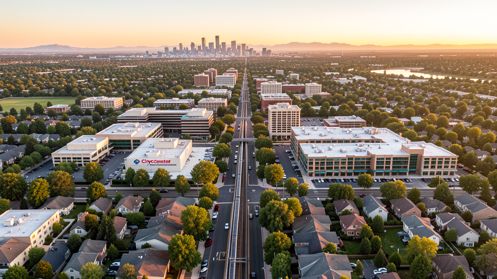
Get Matched With a Local Surveyor
Drone Survey Services Available in Englewood, CO
Englewood is a close-in southern Denver suburb in Arapahoe County, positioned along the RTD light rail corridor with major medical facilities including Swedish Medical Center and UCHealth. The construction market is driven by transit-oriented development, Broadway Corridor revitalization, and medical campus expansion, focused on infill and redevelopment rather than greenfield growth.
Drone Surveys for Englewood's Construction Market
Englewood is a close-in southern Denver suburb with steady redevelopment activity driven by its position along the RTD light rail corridor and the presence of major medical facilities including Swedish Medical Center and the UCHealth campus. The city has seen significant investment in the Englewood Station transit-oriented development, the Broadway Corridor revitalization, and the CityCenter Englewood mixed-use project. Growth is approximately 1.5-2% annually, focused on infill and redevelopment rather than greenfield expansion.
Active Developers in the Area:

Typical Project Costs in Colorado
Cost ranges are based on market data for Denver-Aurora-Lakewood MSA. Actual pricing depends on site size, complexity, and deliverables.
| Service Type | Low End | High End |
|---|---|---|
| Topographic Survey | $1,300 | $4,500 |
| Drone Inspection | $850 | $3,200 |
| LiDAR Scanning | $2,700 | $8,000 |
| Environmental Monitoring | $1,500 | $5,200 |
| Aerial Imagery | $550 | $2,200 |
| Construction Monitoring | $1,000 | $3,600 |
| Real Estate Photography | $350 | $1,400 |
| Roof Inspection | $400 | $1,600 |
Local Airspace & Regulations in Englewood, CO
FAA Part 107 Requirements
All commercial drone operations in Colorado require the pilot to hold an active FAA Part 107 Remote Pilot Certificate. Our network surveyors are verified Part 107 holders.
State Drone Laws
Colorado HB 1070 (2023) aligns state drone law with federal FAA Part 107 requirements. The law prohibits local municipalities from regulating drone flight paths or airspace, but allows cities to regulate takeoff and landing on public property. Colorado does not require a separate state-level drone license. Commercial drone operators must hold a valid FAA Part 107 Remote Pilot Certificate and comply with all federal regulations. The Colorado Department of Transportation has additional guidelines for drone operations near state highways and infrastructure.
Local Ordinances
Englewood Municipal Code regulates drone operations in city parks and open space, requiring prior authorization from the Parks and Recreation Department. Commercial drone operators must carry proof of FAA Part 107 certification and liability insurance. Commercial filming permits are issued through the City Clerks Office. Englewood does not have a standalone drone ordinance but regulates through parks, nuisance, and business licensing provisions.
Restricted Airspace
- KAPA Class D surface area extends 5 NM from Centennial Airport. Southern portions of Englewood may fall within the northern edge of this Class D area. LAANC authorization may be required.
- KDEN Class B shelves at higher altitudes. Standard drone operations below 400 AGL not impacted.
- Swedish Medical Center and UCHealth facilities have medevac helicopter operations. Drone operators should maintain awareness of low-altitude helicopter traffic near medical facilities.
- Buckley Space Force Base (10 miles east) has associated airspace and TFR considerations.
- City parks and open space require authorization for drone takeoff and landing.
Airports in the area: undefined (undefined), undefined (undefined), undefined (undefined)
Why Hire Through Aerius View in Englewood, CO?
FAA-Certified
Every surveyor holds an active Part 107 Remote Pilot Certificate.
Local to Englewood
Surveyors who know the Colorado airspace and local permitting.
No Cost to Quote
Submit your project at no charge. Pay the surveyor directly if you proceed.
Fast Turnaround
A local surveyor contacts you within 2 business days.
How Our Englewood Matching Process Works
We're actively building our network of FAA-certified drone operators in Englewood, CO. Here's exactly what happens when you submit a project request.
Submit Your Project
Tell us your site location, acreage, and what you need (topographic survey, LiDAR, inspection, etc.). Takes 60 seconds. No cost, no obligation.
We Match & Vet
We identify Part 107-certified operators in Colorado with the right equipment for your project. Every pilot is verified for active certification, insurance, and relevant experience in Colorado airspace.
You Get Quotes
Matched surveyors contact you within 2 business days with quotes. You compare pricing, timelines, and deliverables, then choose the right fit. You pay the surveyor directly, no markup.
What Deliverables Do You Get?
Every project includes professional-grade deliverables compatible with standard construction and engineering software:
- Orthomosaic maps (GeoTIFF) for site overview and documentation
- Point clouds (LAS/LAZ) for 3D modeling and volumetric analysis
- DEM/DSM terrain models for cut/fill and grade analysis
- Contour lines (DXF/DWG, CAD-ready) for Civil 3D and Revit
- Progress reports with side-by-side comparisons for construction monitoring
- Coordinate systems matched to your project datum (State Plane, UTM, or local)
Insurance & Liability Protection
Pilot Insurance Required
Every operator in our network must carry active liability insurance. Minimum coverage: $1,000,000 general liability. Proof of insurance is verified before any pilot joins the network.
FAA Part 107 Verified
We confirm each pilot's Remote Pilot Certificate is active and in good standing through the FAA Airmen Inquiry system. Expired certificates are flagged automatically.
Equipment Documentation
Pilots list their drone models, sensors (RGB, LiDAR, thermal, multispectral), and payload specs so we can match the right equipment to your project requirements.
Site Safety Coordination
Pilots coordinate with your site superintendent for safe operations on active construction sites, including flight plans that avoid worker areas and equipment zones.
Englewood, CO Drone Survey FAQs
Does Englewood fall under any controlled airspace requiring LAANC authorization?
Southern portions of Englewood may fall within the northern edge of the KAPA (Centennial Airport) Class D airspace, which extends 5 nautical miles from the airport. Operators should check the FAA UAS Facility Maps for their specific location. Much of northern and central Englewood is outside the Class D surface area.
What construction projects are driving drone survey demand in Englewood?
Transit-oriented development around Englewood Station on the RTD light rail, the Broadway Corridor revitalization, the CityCenter Englewood mixed-use project, and ongoing medical campus expansion at Swedish Medical Center and UCHealth are the primary drivers. The city focus on infill and redevelopment creates consistent demand for topographic and progress monitoring surveys.
Are there medical helicopter traffic considerations for drone operators in Englewood?
Yes. Swedish Medical Center and UCHealth facilities in Englewood have medevac helicopter operations. Drone operators should maintain awareness of low-altitude helicopter traffic near medical facilities, monitor appropriate radio frequencies, and yield right-of-way to all manned aircraft as required by FAA Part 107 regulations.
Can I fly a drone in Englewood city parks?
Drone takeoff and landing in Englewood city parks requires prior authorization from the Parks and Recreation Department. Commercial operators must provide proof of FAA Part 107 certification and liability insurance. Belleview Park, Cornerstone Park, and other city recreation areas are subject to these restrictions.
Do I need a film permit for commercial drone photography in Englewood?
Yes. Commercial filming including drone cinematography on city property requires a film permit from the City Clerks Office. Operators must show proof of FAA Part 107 certification and liability insurance. Flights over private property with owner consent do not require the city permit but still require FAA Part 107 compliance.
Nearby Cities
Are You a Drone Surveyor in Englewood?
Get pre-qualified leads in your service area. No membership fees, no monthly minimums. First lead free.
Ready to Start Your Project in Englewood, CO?
Get matched with a local, FAA-certified surveyor. No cost, no obligation.
Request a Free Quote