Drone Survey Services in Lafayette, CO
Lafayette combines Boulder County tech corridor growth with Old Town revitalization and Coal Creek Trail expansion, creating steady demand for residential infill aerial survey and mixed-use development monitoring.
Serving Boulder County & the Denver-Aurora-Lakewood MSA area
Request a Free Quote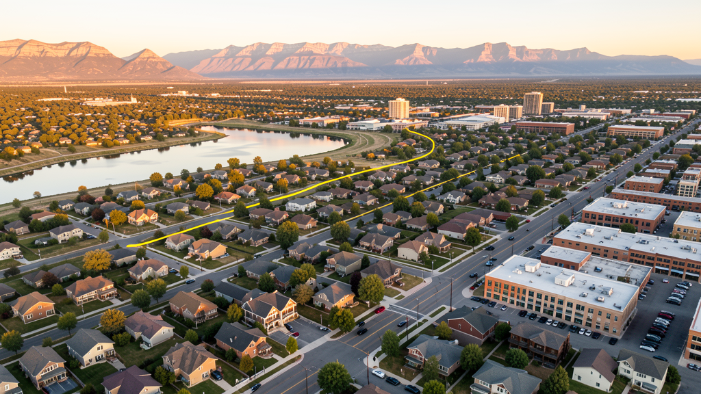
Get Matched With a Local Surveyor
Drone Survey Services Available in Lafayette, CO
Lafayette sits in the Boulder County tech corridor between Boulder and Broomfield, with steady growth driven by its relative affordability compared to Boulder and proximity to both the Denver metro and Northern Colorado. The city combines historic Old Town character with new residential infill and mixed-use development, creating a consistent construction market for drone survey services.
Drone Surveys for Lafayette's Construction Market
Lafayette is experiencing steady growth of approximately 2-3% annually as part of the Boulder County tech corridor. The city has seen significant residential infill development, particularly around the Waneka Lake area and along the Highway 7 corridor. Major projects include the Lafayette Commons mixed-use development, Old Town Lafayette revitalization, and expansion of the Coal Creek Trail system. The city benefits from proximity to both Boulder and the Denver metro, attracting tech workers and driving residential and commercial construction demand.
Active Developers in the Area:

Typical Project Costs in Colorado
Cost ranges are based on market data for Denver-Aurora-Lakewood MSA. Actual pricing depends on site size, complexity, and deliverables.
| Service Type | Low End | High End |
|---|---|---|
| Topographic Survey | $1,300 | $4,800 |
| Drone Inspection | $850 | $3,200 |
| LiDAR Scanning | $2,700 | $8,500 |
| Environmental Monitoring | $1,400 | $4,800 |
| Aerial Imagery | $550 | $2,300 |
| Construction Monitoring | $1,000 | $3,800 |
| Real Estate Photography | $350 | $1,400 |
| Roof Inspection | $400 | $1,600 |
Local Airspace & Regulations in Lafayette, CO
FAA Part 107 Requirements
All commercial drone operations in Colorado require the pilot to hold an active FAA Part 107 Remote Pilot Certificate. Our network surveyors are verified Part 107 holders.
State Drone Laws
Colorado HB 1070 (2023) aligns state drone law with federal FAA Part 107 requirements. The law prohibits local municipalities from regulating drone flight paths or airspace, but allows cities to regulate takeoff and landing on public property. Colorado does not require a separate state-level drone license. Commercial drone operators must hold a valid FAA Part 107 Remote Pilot Certificate and comply with all federal regulations. The Colorado Department of Transportation has additional guidelines for drone operations near state highways and infrastructure.
Local Ordinances
Lafayette Municipal Code prohibits drone takeoff and landing in city parks and open space without prior authorization from the Parks and Recreation Department. Commercial drone operators must provide proof of FAA Part 107 certification and liability insurance. Boulder County Open Space regulations prohibit drone use on county open space properties adjacent to Lafayette. Commercial filming permits are issued through the Lafayette Community Development Department.
Restricted Airspace
- KBJC Class D airspace extends to 8,000 MSL within approximately 4.5 nm. Eastern portions of Lafayette may fall within or near this Class D shelf. LAANC authorization may be required.
- KDEN Class B outer shelves at higher altitudes. Standard drone operations below 400 AGL not impacted.
- Rocky Flats National Wildlife Refuge (5 miles south). USFWS restrictions on overflights; drone operations prohibited on refuge lands.
- Waneka Lake and open space areas have Boulder County open space restrictions on drone operations.
- Coal Creek Trail corridor and Lafayette open space parcels have city restrictions on drone takeoff and landing.
Airports in the area: undefined (undefined), undefined (undefined), undefined (undefined), undefined (undefined)
Why Hire Through Aerius View in Lafayette, CO?
FAA-Certified
Every surveyor holds an active Part 107 Remote Pilot Certificate.
Local to Lafayette
Surveyors who know the Colorado airspace and local permitting.
No Cost to Quote
Submit your project at no charge. Pay the surveyor directly if you proceed.
Fast Turnaround
A local surveyor contacts you within 2 business days.
How Our Lafayette Matching Process Works
We're actively building our network of FAA-certified drone operators in Lafayette, CO. Here's exactly what happens when you submit a project request.
Submit Your Project
Tell us your site location, acreage, and what you need (topographic survey, LiDAR, inspection, etc.). Takes 60 seconds. No cost, no obligation.
We Match & Vet
We identify Part 107-certified operators in Colorado with the right equipment for your project. Every pilot is verified for active certification, insurance, and relevant experience in Colorado airspace.
You Get Quotes
Matched surveyors contact you within 2 business days with quotes. You compare pricing, timelines, and deliverables, then choose the right fit. You pay the surveyor directly, no markup.
What Deliverables Do You Get?
Every project includes professional-grade deliverables compatible with standard construction and engineering software:
- Orthomosaic maps (GeoTIFF) for site overview and documentation
- Point clouds (LAS/LAZ) for 3D modeling and volumetric analysis
- DEM/DSM terrain models for cut/fill and grade analysis
- Contour lines (DXF/DWG, CAD-ready) for Civil 3D and Revit
- Progress reports with side-by-side comparisons for construction monitoring
- Coordinate systems matched to your project datum (State Plane, UTM, or local)
Insurance & Liability Protection
Pilot Insurance Required
Every operator in our network must carry active liability insurance. Minimum coverage: $1,000,000 general liability. Proof of insurance is verified before any pilot joins the network.
FAA Part 107 Verified
We confirm each pilot's Remote Pilot Certificate is active and in good standing through the FAA Airmen Inquiry system. Expired certificates are flagged automatically.
Equipment Documentation
Pilots list their drone models, sensors (RGB, LiDAR, thermal, multispectral), and payload specs so we can match the right equipment to your project requirements.
Site Safety Coordination
Pilots coordinate with your site superintendent for safe operations on active construction sites, including flight plans that avoid worker areas and equipment zones.
Lafayette, CO Drone Survey FAQs
Does the Rocky Mountain Metropolitan Airport Class D airspace affect drone operations in Lafayette?
The KBJC Class D airspace extends to 8,000 feet MSL within approximately 4.5 nautical miles of the airport. Eastern portions of Lafayette may fall within or near this Class D shelf. Drone operators should check the FAA UAS Facility Maps to determine whether their specific flight location requires LAANC authorization. Most of central and western Lafayette is outside the Class D surface area.
Can I fly a drone in Lafayette city parks and open space?
Lafayette Municipal Code prohibits drone takeoff and landing in city parks and open space without prior authorization from the Parks and Recreation Department. Boulder County Open Space properties adjacent to Lafayette also prohibit drone use without a special use permit. The Coal Creek Trail corridor and Waneka Lake area are subject to these restrictions.
What construction projects are driving drone survey demand in Lafayette?
The Lafayette Commons mixed-use development, Old Town Lafayette revitalization, residential infill around Waneka Lake, and the Coal Creek Trail system expansion are the primary drivers. The city growth rate of 2-3% annually creates consistent demand for topographic surveys, construction progress monitoring, and aerial imagery for both residential and commercial projects.
How does Lafayette position between Boulder and Denver affect its drone survey market?
Lafayette straddles the Boulder-Denver corridor, attracting tech workers who want Boulder County access at more affordable prices. This drives steady residential infill and commercial development, creating consistent demand for drone-based survey services. The proximity to both Boulder and Broomfield means operators must navigate multiple airspace jurisdictions depending on flight location.
Are there restrictions near the Rocky Flats National Wildlife Refuge south of Lafayette?
Rocky Flats National Wildlife Refuge, located approximately 5 miles south of Lafayette, is federal land managed by the U.S. Fish and Wildlife Service. Drone operations are prohibited on refuge lands under 50 CFR 27.34. The former nuclear weapons production site has remediated but restricted surface use. Operators flying near the southern boundary of Lafayette should be aware of the refuge no-fly zone.
Nearby Cities
Are You a Drone Surveyor in Lafayette?
Get pre-qualified leads in your service area. No membership fees, no monthly minimums. First lead free.
Ready to Start Your Project in Lafayette, CO?
Get matched with a local, FAA-certified surveyor. No cost, no obligation.
Request a Free Quote