Drone Survey Services in Longmont, CO
From the Village at the Peaks redevelopment to ongoing NextLight fiber expansion, Longmont construction activity spans mixed-use infill and major infrastructure corridor projects.
Serving Boulder County & the Denver-Aurora-Lakewood MSA area
Request a Free Quote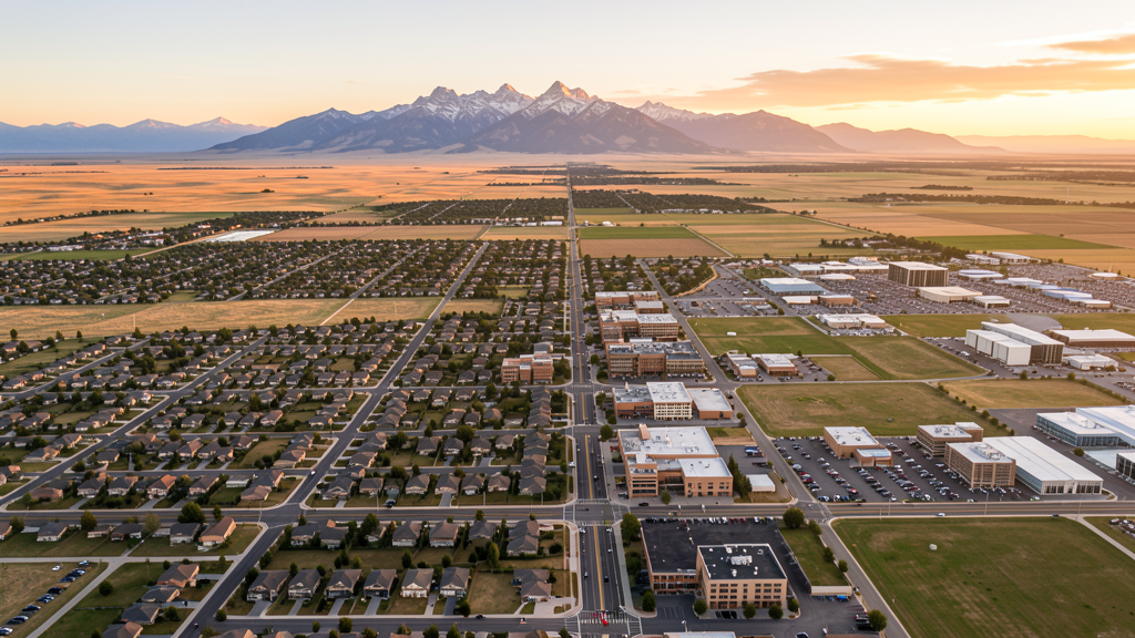
Get Matched With a Local Surveyor
Drone Survey Services Available in Longmont, CO
Longmont is the second-largest city in Boulder County, positioned along the Highway 119 corridor between Boulder and the Northern Colorado metro area. The city has leveraged its municipal fiber network (NextLight) and strategic location to attract tech companies and remote workers, driving residential and commercial construction growth. Longmont combines relatively affordable land compared to Boulder with strong municipal services, making it attractive for both residential developers and commercial businesses.
Drone Surveys for Longmont's Construction Market
Longmont is experiencing rapid growth of approximately 2-3% annually as part of the Boulder County tech corridor, with significant residential expansion east of the city and redevelopment of the downtown Main Street corridor. Major projects include the Village at the Peaks redevelopment (former Twin Peaks Mall site), downtown mixed-use infill projects, and expansion of the Boulder Community Health campus. Infrastructure spending includes the NextLight municipal fiber network expansion, Highway 119 (Diagonal Highway) corridor improvements connecting to Boulder, and new school construction in the St. Vrain Valley School District.
Active Developers in the Area:

Typical Project Costs in Colorado
Cost ranges are based on market data for Denver-Aurora-Lakewood MSA. Actual pricing depends on site size, complexity, and deliverables.
| Service Type | Low End | High End |
|---|---|---|
| Topographic Survey | $1,200 | $4,500 |
| Drone Inspection | $800 | $3,000 |
| LiDAR Scanning | $2,500 | $8,000 |
| Environmental Monitoring | $1,500 | $5,000 |
| Aerial Imagery | $600 | $2,400 |
| Construction Monitoring | $1,000 | $4,000 |
| Real Estate Photography | $300 | $1,100 |
| Roof Inspection | $400 | $1,500 |
Local Airspace & Regulations in Longmont, CO
FAA Part 107 Requirements
All commercial drone operations in Colorado require the pilot to hold an active FAA Part 107 Remote Pilot Certificate. Our network surveyors are verified Part 107 holders.
State Drone Laws
Colorado HB 1070 (2023) aligns state drone law with federal FAA Part 107 requirements. The law prohibits local municipalities from regulating drone flight paths or airspace, but allows cities to regulate takeoff and landing on public property. Colorado does not require a separate state-level drone license. Commercial drone operators must hold a valid FAA Part 107 Remote Pilot Certificate and comply with all federal regulations. The Colorado Department of Transportation has additional guidelines for drone operations near state highways and infrastructure.
Local Ordinances
Longmont Municipal Code Chapter 6.20 requires commercial drone operators to obtain a city business license, with proof of FAA Part 107 certification. Longmont Parks and Recreation rules prohibit drone takeoff and landing in city parks without prior authorization. Longmont Municipal Code Chapter 15.05 requires a film permit for commercial photography and videography using drones, with proof of insurance and Part 107 certification. Longmont operates its own municipal broadband utility (NextLight) and construction activity around fiber infrastructure requires coordination with Longmont Power Communications.
Restricted Airspace
- DEN Class B airspace outer shelves extend into southern Longmont at higher altitudes. Most Part 107 flights under 400 AGL in central and northern Longmont are not affected.
- Rocky Mountain National Park (25 miles west) prohibits drone operations within park boundaries under 36 CFR 1.5. Not a direct factor for Longmont but relevant for operators traveling west.
- CU Boulder game-day TFR (3 nm from Folsom Field) may affect far southwest edge of Longmont on football game days.
- Longs Peak and Mount Meeker area within Rocky Mountain National Park and Roosevelt National Forest: drone restrictions apply on federal lands west of Longmont.
Airports in the area: undefined (undefined), undefined (undefined), undefined (undefined), undefined (undefined)
Why Hire Through Aerius View in Longmont, CO?
FAA-Certified
Every surveyor holds an active Part 107 Remote Pilot Certificate.
Local to Longmont
Surveyors who know the Colorado airspace and local permitting.
No Cost to Quote
Submit your project at no charge. Pay the surveyor directly if you proceed.
Fast Turnaround
A local surveyor contacts you within 2 business days.
How Our Longmont Matching Process Works
We're actively building our network of FAA-certified drone operators in Longmont, CO. Here's exactly what happens when you submit a project request.
Submit Your Project
Tell us your site location, acreage, and what you need (topographic survey, LiDAR, inspection, etc.). Takes 60 seconds. No cost, no obligation.
We Match & Vet
We identify Part 107-certified operators in Colorado with the right equipment for your project. Every pilot is verified for active certification, insurance, and relevant experience in Colorado airspace.
You Get Quotes
Matched surveyors contact you within 2 business days with quotes. You compare pricing, timelines, and deliverables, then choose the right fit. You pay the surveyor directly, no markup.
What Deliverables Do You Get?
Every project includes professional-grade deliverables compatible with standard construction and engineering software:
- Orthomosaic maps (GeoTIFF) for site overview and documentation
- Point clouds (LAS/LAZ) for 3D modeling and volumetric analysis
- DEM/DSM terrain models for cut/fill and grade analysis
- Contour lines (DXF/DWG, CAD-ready) for Civil 3D and Revit
- Progress reports with side-by-side comparisons for construction monitoring
- Coordinate systems matched to your project datum (State Plane, UTM, or local)
Insurance & Liability Protection
Pilot Insurance Required
Every operator in our network must carry active liability insurance. Minimum coverage: $1,000,000 general liability. Proof of insurance is verified before any pilot joins the network.
FAA Part 107 Verified
We confirm each pilot's Remote Pilot Certificate is active and in good standing through the FAA Airmen Inquiry system. Expired certificates are flagged automatically.
Equipment Documentation
Pilots list their drone models, sensors (RGB, LiDAR, thermal, multispectral), and payload specs so we can match the right equipment to your project requirements.
Site Safety Coordination
Pilots coordinate with your site superintendent for safe operations on active construction sites, including flight plans that avoid worker areas and equipment zones.
Longmont, CO Drone Survey FAQs
What airspace considerations apply to drone operations near Vance Brand Municipal Airport in Longmont?
Vance Brand Municipal Airport (LMO/KLMO) is an untowered GA airport with Class G airspace, meaning no specific airspace authorization is required for drone operations under 400 AGL in the immediate vicinity. However, operators must still yield right-of-way to manned aircraft and avoid interfering with airport traffic patterns. The airport is located about 2 miles southwest of downtown Longmont.
Do I need a city business license to operate a commercial drone business in Longmont?
Yes. Under Longmont Municipal Code Chapter 6.20, commercial drone operators must obtain a city business license. The application requires proof of FAA Part 107 Remote Pilot Certification and proof of general liability insurance. Additional film permits under Chapter 15.05 may be required for specific commercial photography or videography projects on city property.
How does the Village at the Peaks redevelopment affect construction drone survey demand in Longmont?
The Village at the Peaks redevelopment, led by McWhinney on the former Twin Peaks Mall site, represents one of the largest mixed-use redevelopment projects in Longmont history. The project includes retail, residential, and commercial components that require ongoing site surveying, progress monitoring, and as-built documentation. Surrounding infill development along Main Street has created sustained demand for drone-based construction documentation.
Can I fly a drone over Longmont city parks?
Drone takeoff and landing in Longmont city parks requires prior authorization from the Longmont Parks and Recreation Department. Operators should submit a request detailing the purpose, date, time, and scope of operations. Commercial operations additionally require a city business license and film permit.
What infrastructure projects in Longmont create opportunities for drone surveying?
Longmont has several active infrastructure programs: the NextLight municipal fiber network expansion requires pre-construction surveys, Highway 119 (Diagonal Highway) corridor improvements connecting Longmont to Boulder, St. Vrain Valley School District new school construction, and ongoing St. Vrain Creek flood recovery and channel stabilization projects. These require topographic mapping, progress monitoring, and earthwork volume calculations.
Nearby Cities
Are You a Drone Surveyor in Longmont?
Get pre-qualified leads in your service area. No membership fees, no monthly minimums. First lead free.
Ready to Start Your Project in Longmont, CO?
Get matched with a local, FAA-certified surveyor. No cost, no obligation.
Request a Free Quote