Drone Survey Services in Boulder, CO
From CU Boulder campus expansion to ongoing flood mitigation along Boulder Creek, construction activity in the city demands precision surveying in a constrained, open-space-bounded market.
Serving Boulder County & the Denver-Aurora-Lakewood MSA area
Request a Free Quote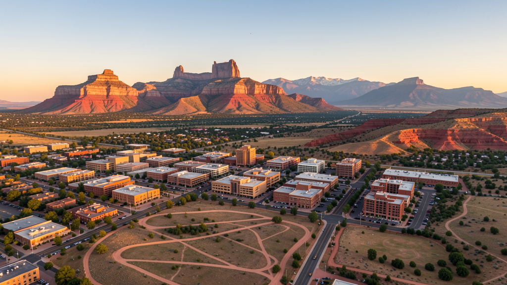
Get Matched With a Local Surveyor
Drone Survey Services Available in Boulder, CO
Boulder sits at the base of the Rocky Mountain foothills northwest of Denver, anchoring a tech-heavy economy driven by the University of Colorado, federal research labs (NOAA, NIST), and a growing cluster of aerospace and software companies. The city urban growth boundary and extensive open space holdings create a constrained development environment that pushes new construction toward infill redevelopment and campus expansion rather than greenfield sprawl.
Drone Surveys for Boulder's Construction Market
Boulder maintains a constrained growth rate of approximately 1-2% annually due to the city urban growth boundary and extensive open space encirclement. Major construction activity centers on CU Boulder campus expansion including the Aerospace Research Center and new residence halls, plus ongoing downtown Pearl Street mixed-use redevelopment. Infrastructure spending focuses on flood mitigation projects from the 2013 flood recovery, bicycle and multi-use path expansion, and municipal fiber upgrades. Commercial development is limited by available land, driving higher property values and focused redevelopment of existing sites.
Active Developers in the Area:

Typical Project Costs in Colorado
Cost ranges are based on market data for Denver-Aurora-Lakewood MSA. Actual pricing depends on site size, complexity, and deliverables.
| Service Type | Low End | High End |
|---|---|---|
| Topographic Survey | $1,300 | $4,800 |
| Drone Inspection | $850 | $3,200 |
| LiDAR Scanning | $2,800 | $8,500 |
| Environmental Monitoring | $1,600 | $5,200 |
| Aerial Imagery | $650 | $2,600 |
| Construction Monitoring | $1,100 | $4,200 |
| Real Estate Photography | $350 | $1,200 |
| Roof Inspection | $450 | $1,600 |
Local Airspace & Regulations in Boulder, CO
FAA Part 107 Requirements
All commercial drone operations in Colorado require the pilot to hold an active FAA Part 107 Remote Pilot Certificate. Our network surveyors are verified Part 107 holders.
State Drone Laws
Colorado HB 1070 (2023) aligns state drone law with federal FAA Part 107 requirements. The law prohibits local municipalities from regulating drone flight paths or airspace, but allows cities to regulate takeoff and landing on public property. Colorado does not require a separate state-level drone license. Commercial drone operators must hold a valid FAA Part 107 Remote Pilot Certificate and comply with all federal regulations. The Colorado Department of Transportation has additional guidelines for drone operations near state highways and infrastructure.
Local Ordinances
Boulder Municipal Code 5-4-7 prohibits operation of model aircraft and UAS from city parks and open space lands without a special use permit. Takeoff and landing specifically prohibited on OSMP property. Boulder Municipal Code Chapter 11-1 requires a city film permit for commercial drone photography through the Office of Special Events, with proof of insurance and FAA Part 107 certification. CU Boulder campus policy prohibits drone operation on campus property without authorization from CU Facilities Management and CU Police Department.
Restricted Airspace
- DEN Class B airspace has multiple shelf layers extending across the Front Range. While the Class B surface area does not directly overlie Boulder, higher-altitude shelves may affect operations in eastern Boulder. Most Part 107 flights under 400 AGL in central and western Boulder are not affected.
- Rocky Mountain National Park (approximately 25 miles northwest) prohibits drone operations over park lands under 36 CFR 1.5 and 36 CFR 1000.4. Drone takeoff and landing prohibited within park boundaries.
- CU Boulder Folsom Field game-day TFR (FAA 9933.1.C.19) on University of Colorado football game days: 3-nm radius, up to 3,000 AGL, 1 hour before to 1 hour after events. Covers significant portion of central Boulder during football season (September through November).
- Boulder Open Space and Mountain Parks (OSMP) prohibits drone takeoff, landing, and operation on all OSMP properties. These lands surround much of the western city boundary including Chautauqua and Boulder Creek Path west of town.
Airports in the area: undefined (undefined), undefined (undefined), undefined (undefined), undefined (undefined)
Why Hire Through Aerius View in Boulder, CO?
FAA-Certified
Every surveyor holds an active Part 107 Remote Pilot Certificate.
Local to Boulder
Surveyors who know the Colorado airspace and local permitting.
No Cost to Quote
Submit your project at no charge. Pay the surveyor directly if you proceed.
Fast Turnaround
A local surveyor contacts you within 2 business days.
How Our Boulder Matching Process Works
We're actively building our network of FAA-certified drone operators in Boulder, CO. Here's exactly what happens when you submit a project request.
Submit Your Project
Tell us your site location, acreage, and what you need (topographic survey, LiDAR, inspection, etc.). Takes 60 seconds. No cost, no obligation.
We Match & Vet
We identify Part 107-certified operators in Colorado with the right equipment for your project. Every pilot is verified for active certification, insurance, and relevant experience in Colorado airspace.
You Get Quotes
Matched surveyors contact you within 2 business days with quotes. You compare pricing, timelines, and deliverables, then choose the right fit. You pay the surveyor directly, no markup.
What Deliverables Do You Get?
Every project includes professional-grade deliverables compatible with standard construction and engineering software:
- Orthomosaic maps (GeoTIFF) for site overview and documentation
- Point clouds (LAS/LAZ) for 3D modeling and volumetric analysis
- DEM/DSM terrain models for cut/fill and grade analysis
- Contour lines (DXF/DWG, CAD-ready) for Civil 3D and Revit
- Progress reports with side-by-side comparisons for construction monitoring
- Coordinate systems matched to your project datum (State Plane, UTM, or local)
Insurance & Liability Protection
Pilot Insurance Required
Every operator in our network must carry active liability insurance. Minimum coverage: $1,000,000 general liability. Proof of insurance is verified before any pilot joins the network.
FAA Part 107 Verified
We confirm each pilot's Remote Pilot Certificate is active and in good standing through the FAA Airmen Inquiry system. Expired certificates are flagged automatically.
Equipment Documentation
Pilots list their drone models, sensors (RGB, LiDAR, thermal, multispectral), and payload specs so we can match the right equipment to your project requirements.
Site Safety Coordination
Pilots coordinate with your site superintendent for safe operations on active construction sites, including flight plans that avoid worker areas and equipment zones.
Boulder, CO Drone Survey FAQs
Can I fly a drone over Boulder Open Space and Mountain Parks?
No. Boulder OSMP regulations prohibit drone takeoff, landing, and operation on all open space and mountain parks properties. This covers a large portion of the land surrounding western Boulder, including popular areas like Chautauqua and the Boulder Creek Path west of town. Operators must find private property or city-approved locations for takeoff and landing, even if flying over open space at legal altitudes.
How does the Denver Class B airspace affect drone flights in Boulder?
Denver International Airport Class B airspace has multiple shelf layers extending across the Front Range. While the Class B surface area does not directly overlie Boulder, higher-altitude shelves may affect operations in eastern Boulder. Most recreational and Part 107 flights under 400 AGL in central and western Boulder are not affected by Class B shelves.
Do I need a film permit for commercial drone photography in Boulder?
Yes. Under Boulder Municipal Code Chapter 11-1, commercial drone photography requires a city film permit through the Office of Special Events. The application must include proof of insurance (typically $1M general liability), FAA Part 107 Remote Pilot Certification, and a site plan. Processing time is generally 5-10 business days.
Are there game-day flight restrictions near CU Boulder?
Yes. On University of Colorado football game days at Folsom Field, a Temporary Flight Restriction applies within a 3-nautical-mile radius up to 3,000 feet AGL, from one hour before to one hour after the event. This TFR (per FAA regulation 9933.1.C.19) covers a significant portion of central Boulder and affects all drone operations, including Part 107 commercial flights.
What makes Boulder unique for construction drone surveys?
Boulder combines a constrained urban growth boundary with active university expansion and ongoing flood mitigation projects. The limited available land means developers focus on infill and redevelopment, requiring precise site surveys. The surrounding mountainous terrain and open space create complex topographic conditions ideal for drone-based surveying, but operators must navigate OSMP restrictions and Rocky Mountain National Park airspace to the northwest.
Nearby Cities
Are You a Drone Surveyor in Boulder?
Get pre-qualified leads in your service area. No membership fees, no monthly minimums. First lead free.
Ready to Start Your Project in Boulder, CO?
Get matched with a local, FAA-certified surveyor. No cost, no obligation.
Request a Free Quote